
Solution
Distribution maps of finds
Import the coordinates of the archaeological finds and see them over the orthophoto and terrain model of the site.
Product
Sectors
What it's for
Bring finds and survey into one map.
Import the find points as a layer and see them over the orthophoto. Measure distances between finds and structures and share the map with the team.
Drag to see the finds.
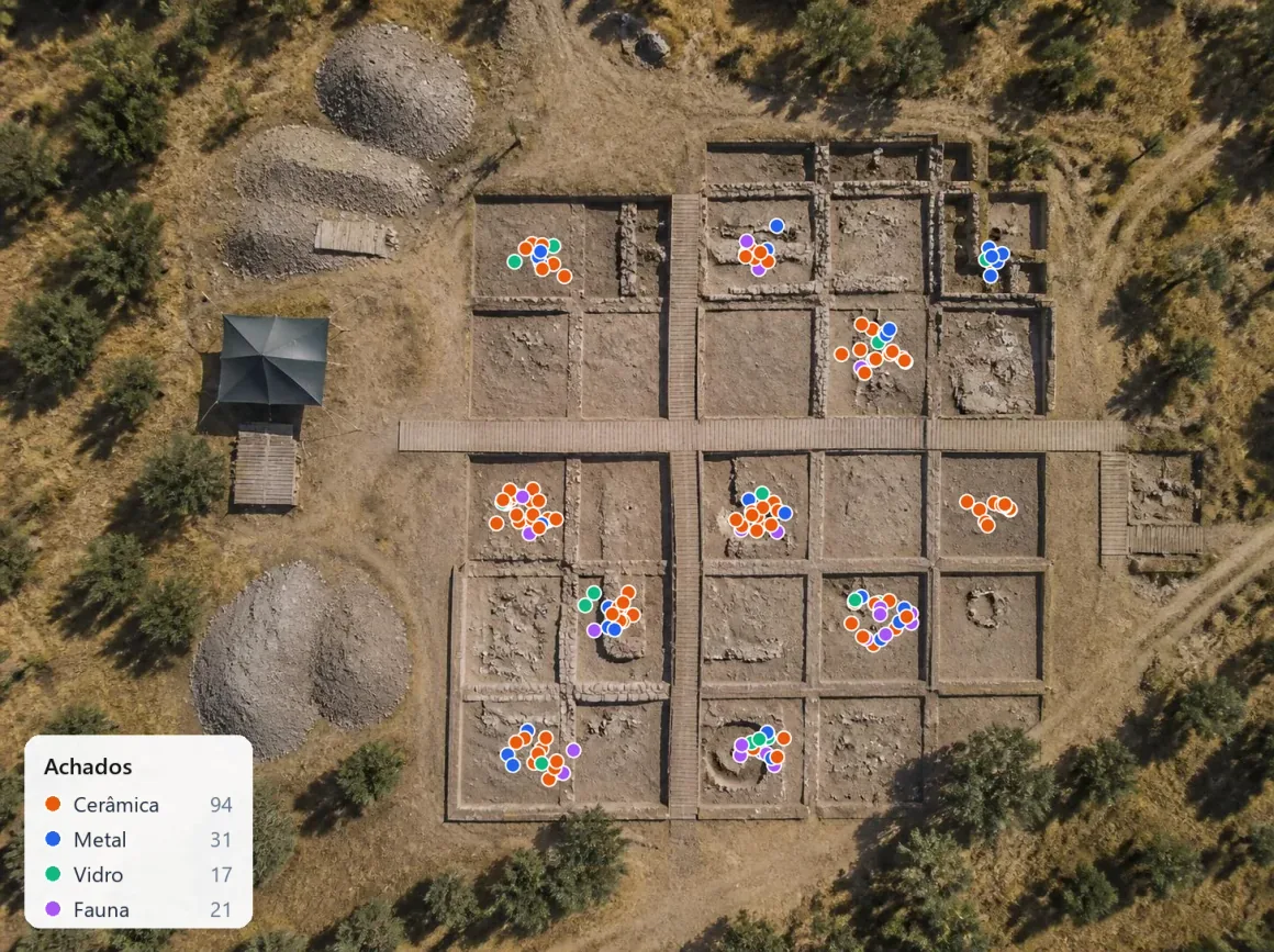
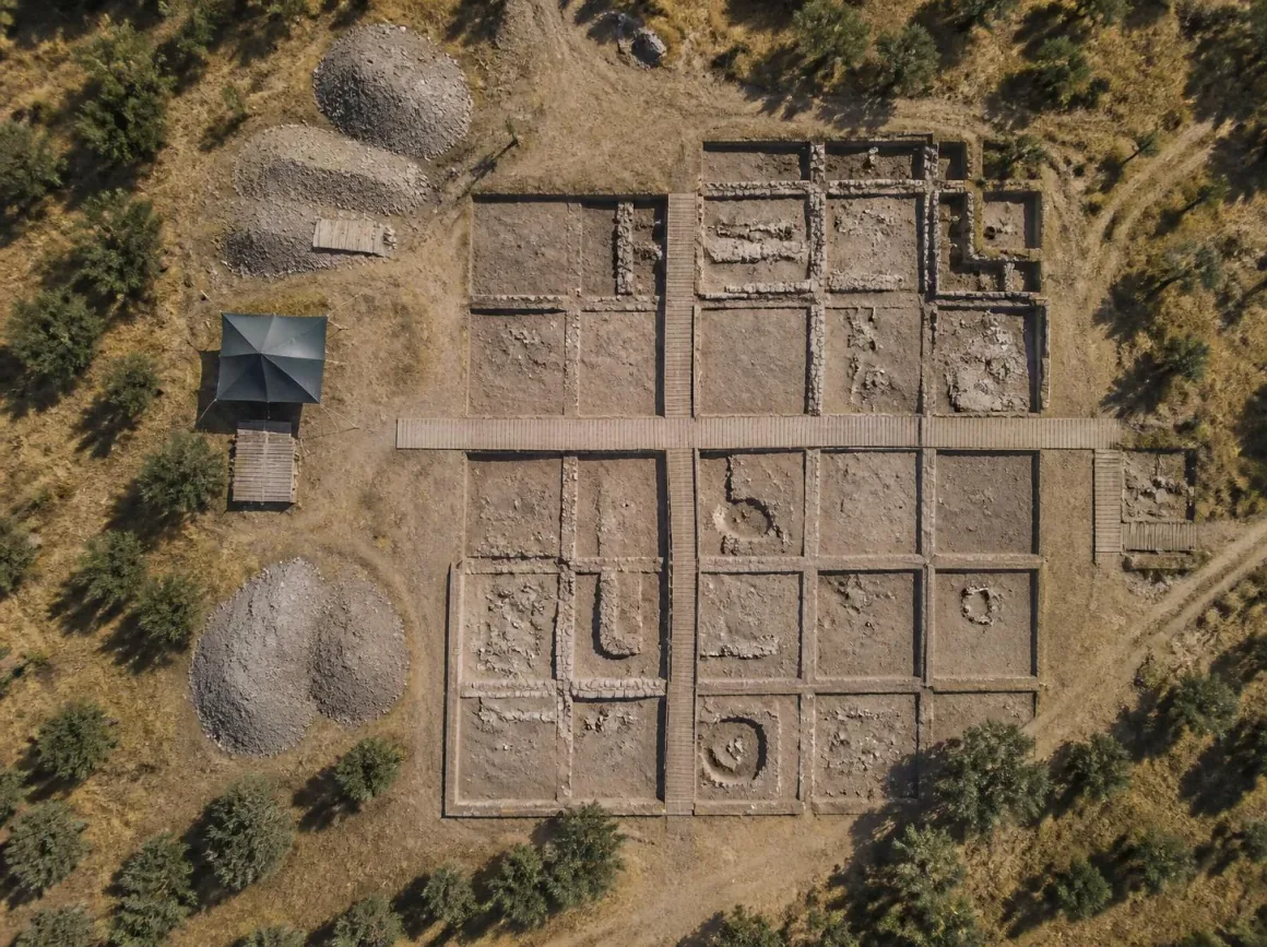 OrthophotoFinds
What you need
A survey of the site and the coordinates of the finds.
Upload the flight data or import the orthophoto and digital terrain model. Add the list of finds with coordinates in the same system as the survey.
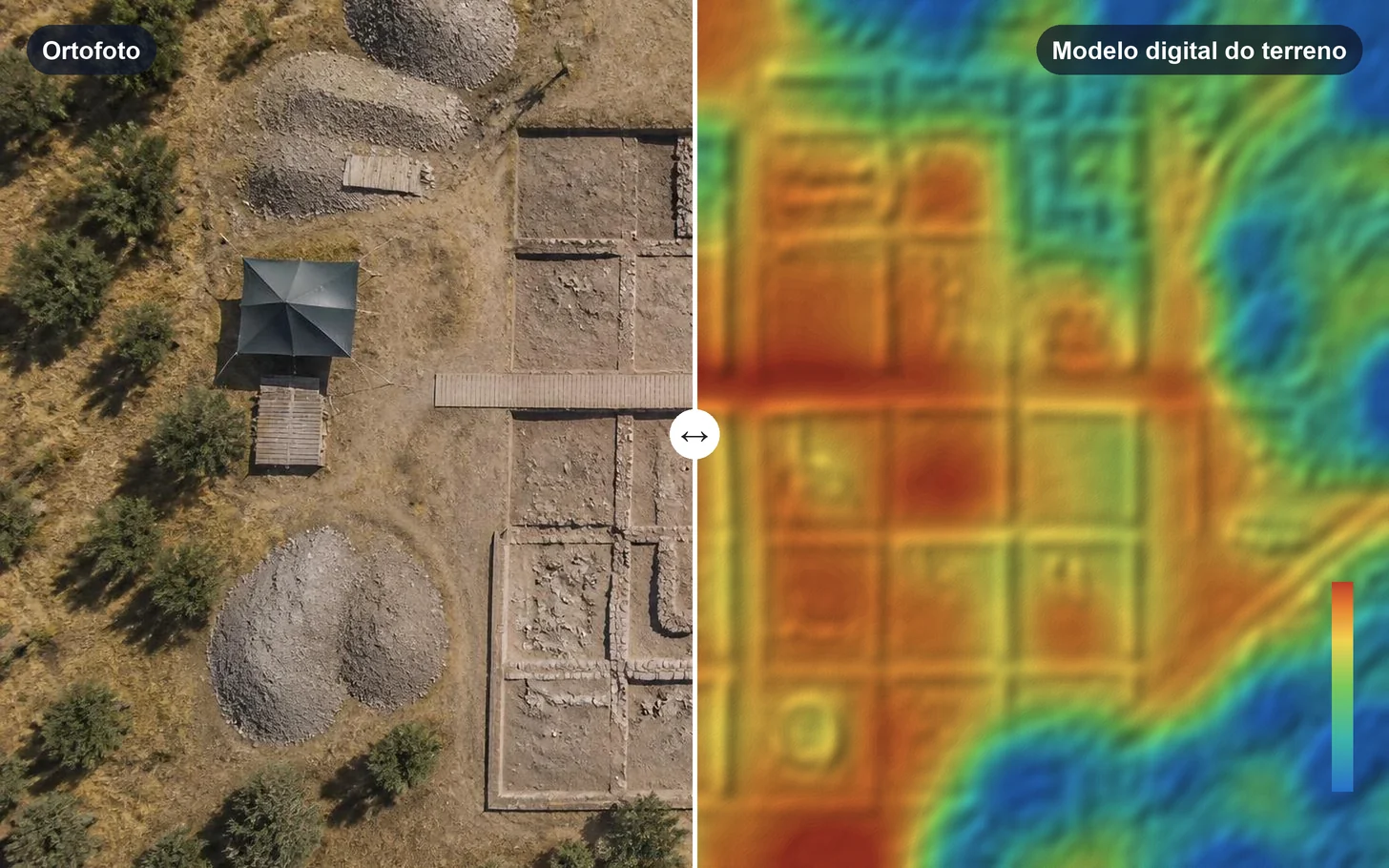
Step by step
- 01
Upload
Upload data or the results from each flight.
- 02
Process
Turn data into results.
- 03
Compare
Compare surveys and see what changed.
- 04
Measure
Measure areas, distances and volumes.
- 05
Share
Share the result with your client or a colleague.
Results
A map with every find in its place.
You get the distribution of the finds over the orthophoto and terrain model, ready to view, measure, share or export.
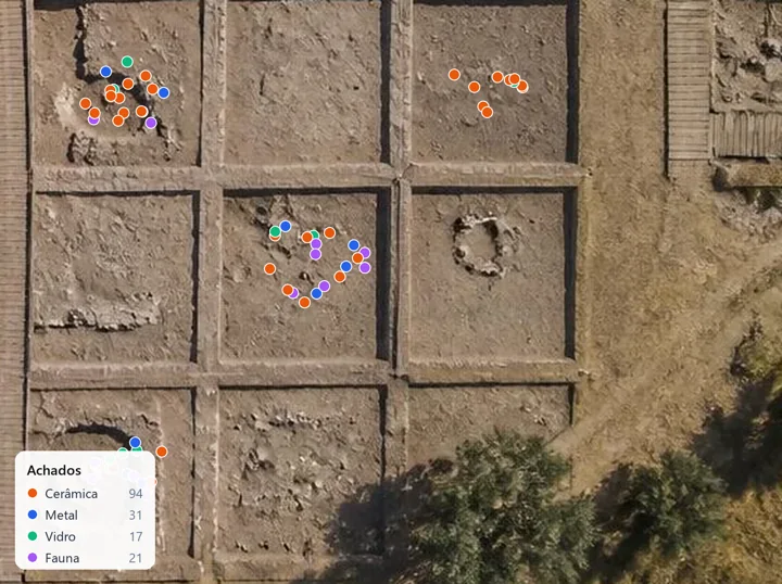
Distribution map of the finds
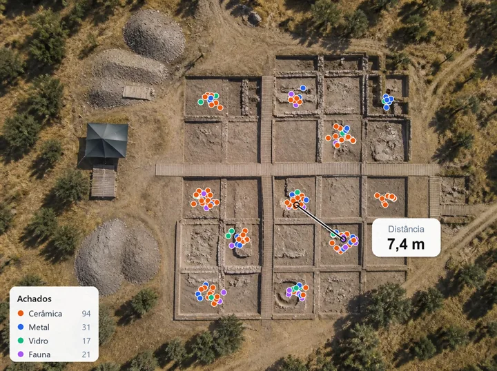
Distances between finds and structures
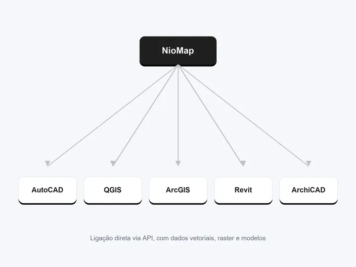
Export via API to QGIS, ArcGIS and AutoCAD
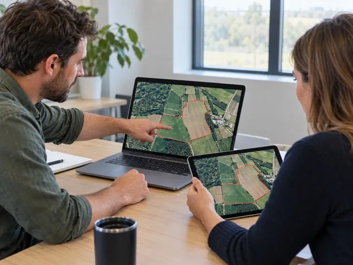
Sharing with the team and authorities
Important note. Use the same coordinate system for the finds and the survey.
FAQ
What people usually ask.
What file do I need for the finds?
A table or point layer with the coordinates of each find, in the survey's system.
Can I measure on the map?
Yes. Distances, areas and elevations are measured on the orthophoto and terrain model.
Can I share the map?
Yes. Invite the team by email or send a share link.
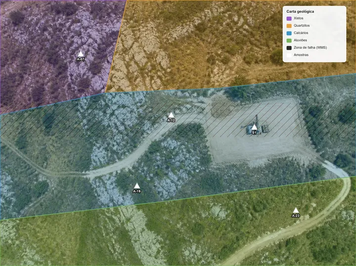
Combine mapping and surveys
Import vector data, rasters and elevation models, or connect WMS or WMTS services such as satellite imagery and vegetation indices, and see them over the survey, in the same coordinate system.
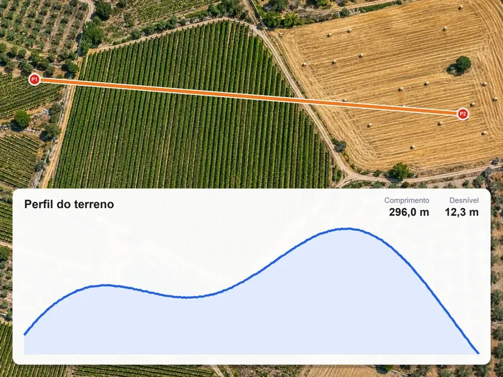
Measure elevations, distances and profiles
Mark points or draw a line on the map and get elevations, distances and the terrain profile, with its length, elevation difference and slope.
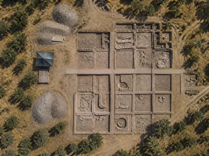
Document site conditions
Orthophoto and 3D model of the site, kept with the capture date, to look up and show even after the site changes.
See your finds in NioMap.
Create a free account and try it with your own survey data: it includes 1 hour of processing and 10 GB of storage. If you have questions, talk to us.