UAVs / Drones
Advanced Aerial Data Capture
Why are drones essential for NIOMAP?
NIOMAP is specifically designed to process data captured by drones, converting aerial images into high-precision 2D maps, 3D models, and point clouds.
To fully leverage NIOMAP’s capabilities, compatible drones are required to ensure accurate and efficient geospatial data collection for a wide range of applications.
Seamless Integration
Compatible with leading drone models for direct processing in NIOMAP.
Accuracy & Efficiency
High-resolution aerial imagery minimizes errors and optimizes analysis.
Advantages of Using Drones with NIOMAP
NIOMAP leverages aerial data captured by drones to maximize efficiency, accuracy, and operational control.
Accuracy & Efficiency
High-resolution aerial imagery minimizes errors and optimizes analysis.
Seamless Integration
Compatible with major drone models for direct processing in NIOMAP.
Cost Reduction
Replaces traditional survey methods with a faster and more cost-effective solution.
Versatility
Adapts to multiple industries and project types, ensuring greater operational control and safety.
Using Drones with NIOTANTEK® NIOMAP
Centimeter-Level Precision for Geospatial Analysis
Drones equipped with RTK and PPK technology deliver unmatched precision, crucial for safe and effective decision-making.
Automatic & Intelligent Cloud Processing
NIOMAP converts raw drone data into structured information, accessible from anywhere, with no need for specialized hardware.
Centimeter-Level Accuracy for Unmatched Precision
Drones integrated with NIOMAP ensure precise data collection for superior mapping and geospatial analysis.
RTK & PPK Technology
Receive real-time corrections for centimeter-level accuracy in mapping and surveying.
Volumetric Calculations
Accurately measure stockpiles, excavations, and terrain changes with 3D models generated by drones.
Infrastructure & Land Analysis
Enhance land and asset management with high-resolution aerial imagery.
See the drones we useEnvironmental Monitoring
Monitor land use, vegetation, and erosion with spatial data generated by drones.
Automated Cloud Processing for Enhanced Insights
NIOMAP automatically processes aerial data, delivering actionable insights with minimal effort.
Advanced Photogrammetry
Transform drone images into detailed 2D maps and 3D models, enhanced with AI precision.
Automatic Volume & Area Analysis
Instantly calculate measurements for land development, mining, and construction.
Cloud-Based Data Access
Securely access your processed data anytime, anywhere.
See the drones we useReal-Time Collaboration
Easily share data with teams and stakeholders to improve decision-making.
Data Processed with NIOMAP
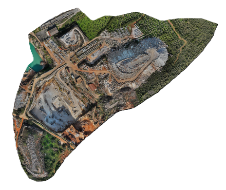
Upload drone-captured images into NIOMAP and transform raw aerial data into high-precision geospatial results for mining, construction, and environmental projects.
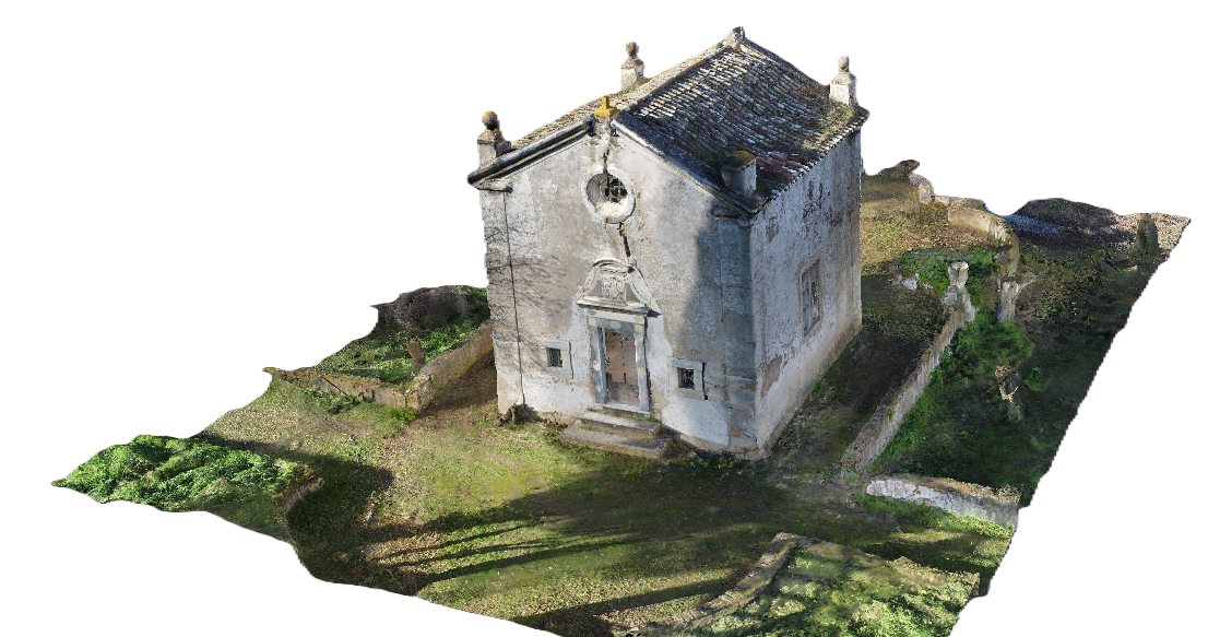
Process aerial imagery into detailed 3D models of terrains, quarries, and mining sites, enabling volumetric analysis, structural monitoring, and precise project planning.
Generate high-resolution, georeferenced orthophotos from drone imagery, essential for precise mapping, surveying, and infrastructure development.
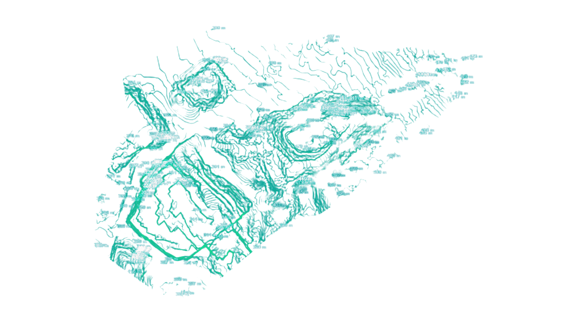
Extract accurate contour lines from drone data to analyze terrain elevations, slopes, and excavation areas, improving resource planning and site management.
High-Resolution Cavity Images
Capture and transfer high-definition images of underground cavities and inaccessible areas, providing detailed visual inspection for mining and excavation projects.
Raster Digital Elevation Model
Generate high-precision raster-based elevation models, essential for terrain analysis, hydrology studies, and infrastructure planning.
Discover Drones Compatible with NIOTANTEK® NIOMAP
Explore professional-grade drones that integrate seamlessly with NIOMAP for advanced geospatial data collection and analysis.
View Compatible DronesDrones Compatible with NIOTANTEK® NIOMAP
Explore professional UAVs that ensure high-precision geospatial data collection and seamless integration with NIOMAP.
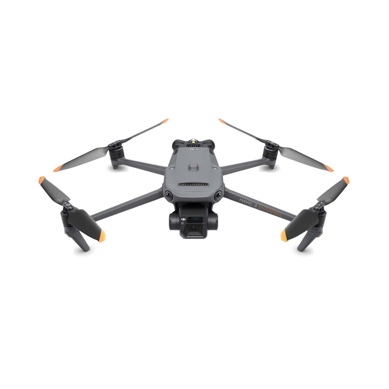
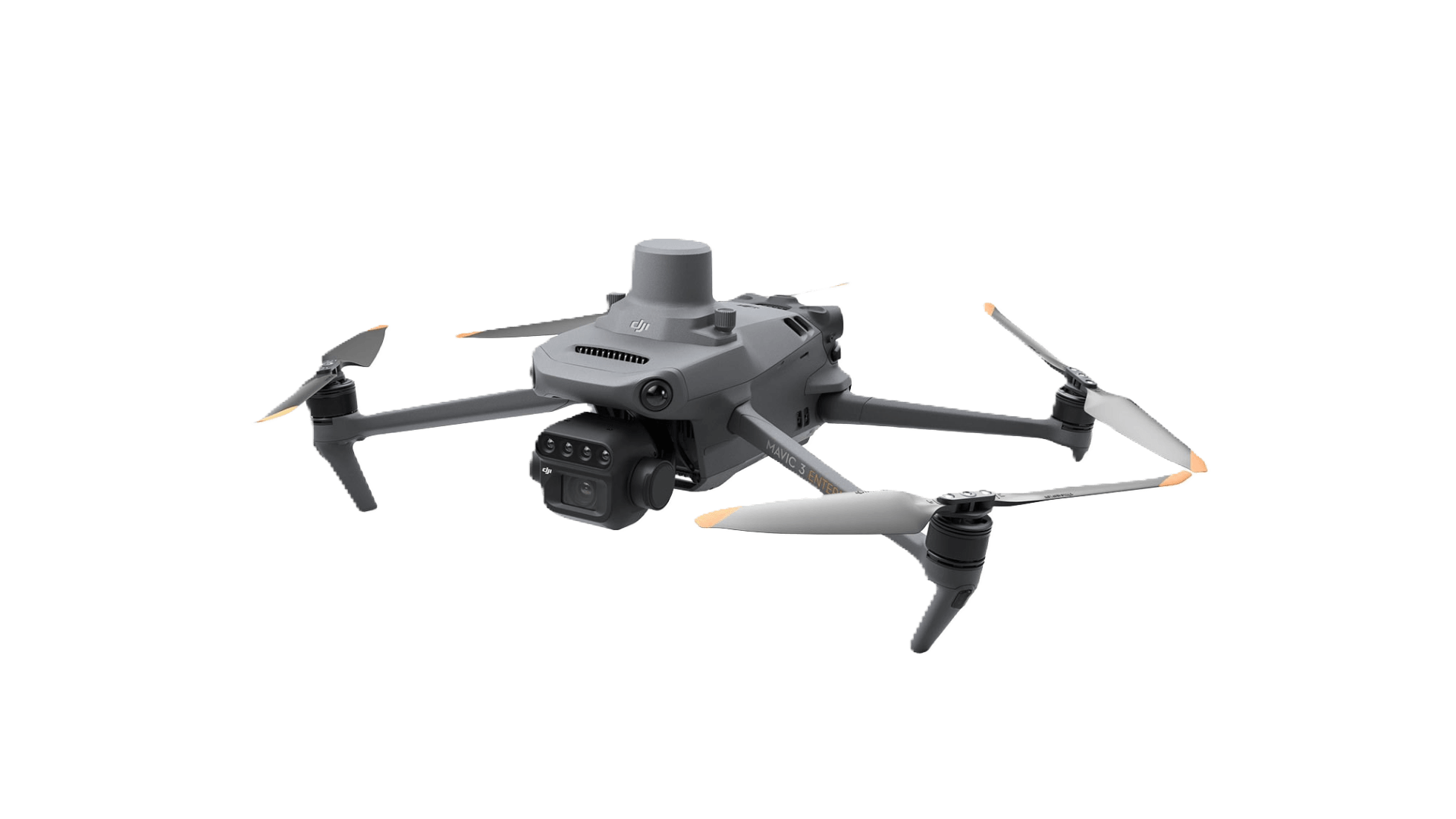
DJI Matrice 4E
The DJI Mavic 3 Enterprise RTK is a compact, high-precision drone, ideal for topographic surveying and mapping with NIOTANTEK® NIOMAP. Equipped with an RTK module, it ensures centimeter-level accuracy, optimizing geospatial data collection for industries such as mining, construction, and environmental monitoring.
Designed for High-Precision Mapping
This drone integrates seamlessly with NIOTANTEK® NIOMAP to transform aerial imagery into high-resolution 2D maps, 3D models, and elevation data. Its powerful sensors and advanced technology make it an essential tool for professionals requiring detailed geospatial analysis.
For more details on drone options and training availability, visit our pricing page.
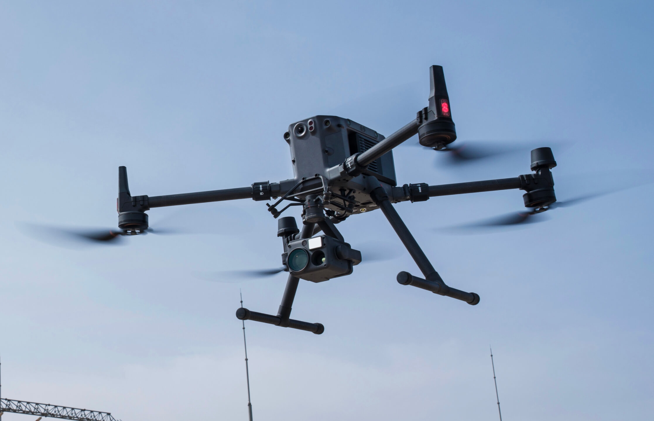
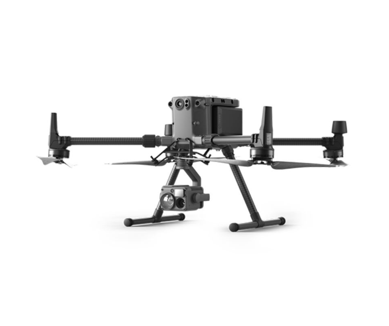
DJI Matrice 350 RTK
The DJI Matrice 350 RTK is a versatile and robust drone built for demanding industrial applications. With enhanced flight performance and centimeter-level positioning accuracy, it is the perfect solution for medium- to large-scale mapping, mining operations, and infrastructure inspections when used with NIOTANTEK® NIOMAP.
Designed for Industrial-Scale Operations
Built to handle complex missions, the Matrice 350 RTK supports high-precision data collection even in challenging environments. Its advanced payload capacity and robust design make it an indispensable tool for professionals demanding reliability and unmatched accuracy.
For more details on drone options and training availability, visit our pricing page.
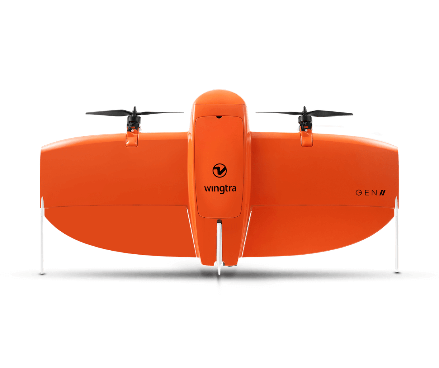
WingtraOne Gen II
The WingtraOne Gen II is a high-performance VTOL (Vertical Takeoff and Landing) drone, designed for efficient, large-scale aerial surveys. Combining the autonomy of a fixed-wing aircraft with the flexibility of a multi-rotor, it is the ideal choice for professionals who need to map extensive areas with unparalleled precision using NIOTANTEK® NIOMAP.
Maximum Coverage with High-Resolution Data
The WingtraOne Gen II covers larger areas in a single flight, capturing high-resolution orthophotos, 3D models, and elevation data. Its advanced flight stability and sensor compatibility make it a key solution for industries such as mining, agriculture, and environmental monitoring.
For more details on drone options and training availability, visit our pricing page.

Check Pricing & Training Options
Explore available UAVs and training programs to maximize your efficiency with NIOTANTEK® NIOMAP.